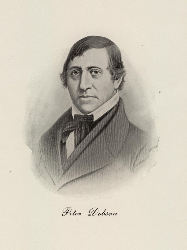
 This "east" site had been owned by Chester King, whom operated a saw mill there. Previous to King, the saw mill was owned by Roger Wolcott, Governor of Connecticut. On December 25, 1809, Chester King was sold one third of the privilege to Peter Dobson and one third jointly to James Chapman, Aaron Chapman under the style "Peter Dobson & Company". Peter Dobson began construction immediately and the mill was in operation in early spring of 1811. Machinery consisted of two mules of one hundred and ninety two spindles each, a throstle-frame of forty eight spindles, and a twisting machine of thirty six spindles. The product produced was stocking yarn and yarn for weaving cloth, which was given to locals whom owned hand-looms, to be woven by them. The fabrics were sheetings, shirtings, stripes, checks and ginghams.
In 1813, Aaron Chapman sold his one-sixth interest to his brother, James Chapman. Several months later, James Chapman sold his entire one-third interest to Walter Mitchell whom, two days later, sold one half of his interest to Ward Woodbridge.
After three years of successful operation, the business applied to the Legislature to incorporate, and in an 1814 Connecticut Legislative Act, Peter Dobson, Chester King, Ward Woodbridge, and Walter Mitchell were incorporated as the "Tankerhoosen Cotton Factory".
At this time, we need to mention the second mill, the west mill, of which its ruins lay in the woods a few hundred yards downstream of present day Dobson Road Bridge. The Tankerhoosen Cotton Factory purchased land along the river, about a quarter of a mile west of the first mill, from Irad Fuller in 1822, and Peter Dobson began erecting a second mill. It is believed that during the construction of this mill, Peter Dobson developed his "Glacial Theory", which is described here. It appears that this mill wasn't brought into operation until approximately 1826, and was destroyed by a fire on March 6, 1827. The mill was immediately rebuilt.
The two mills of the Tankerhoosen Cotton Factory operated successfully under the management of Peter Dobson until 1837, when parties indebted to the company failed, and the business was compelled to make an assignment. A settlement was made with its creditors and a new organization was formed under the style "Centerville Company", with its shareholders being mostly subscribers of the former company. Oliver King was elected president of the company, with Peter Dobson assuming the duties of secretary, agent and treasurer. Three years later, in 1841, Peter Dobson was elected president, agent and treasurer, and his son, John S. Dobson was elected secretary.
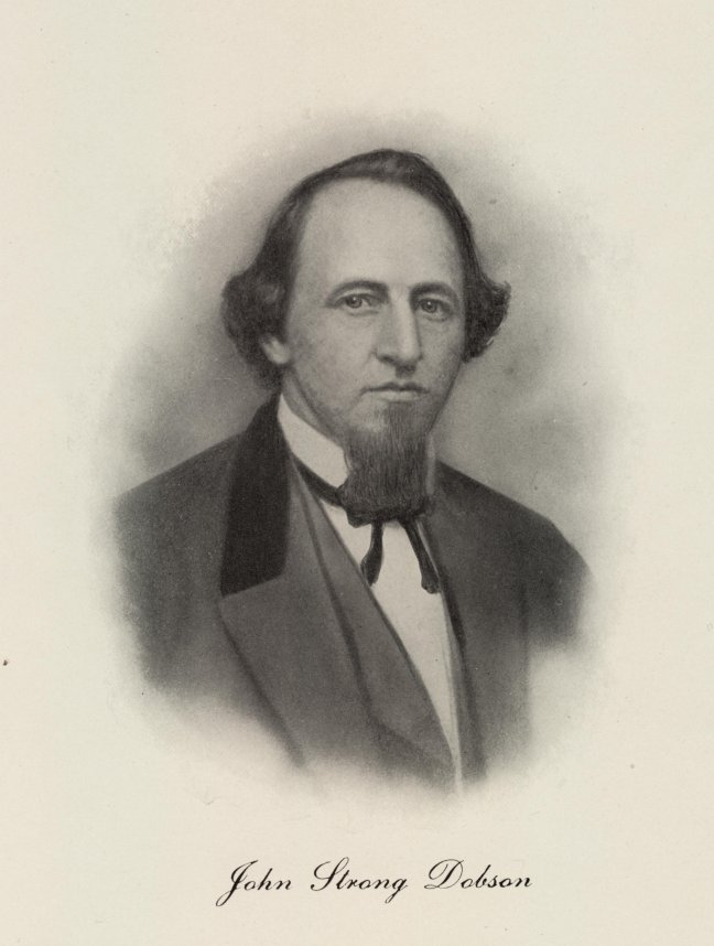 From this time until the Civil War, the company was wholly under the charge of Peter and John Dobson. Their interests in the company continued to grow and by January of 1852, they had together owned more than three-fourths of the company stock. In that year, the east mill was rebuilt and updated. At the commencement of the Civil War, the increasing cost of cotton made it impossible to operate the mills at a profit, and it was decided to close them until the cost was such that a profit could once again be made. At that time, Peter Dobson was nearly eighty years old.
At the close of the war, the cost of cotton had reduced and the resumption of operations was warranted. Because of his age, the elder Dobson did not return to manage the company and it was decided to close up the company and sell its property.
On March 27, 1866, the west mill was sold to John S. Dobson, Alfred R. Goodrich, J. Woodbridge White, and William H. White, whom organized under the style "Dobson, White & Company". Alfred Goodrich was John Dobsons brother-in-law, as he was married to Charlotte, John's sister. Messrs White were brothers-in-law of John Dobson, their sister, Julia being John's wife. On November 20, 1866, J. Woodbridge White retired from the company, at which time he conveyed his interest to his brother, William H. White. Dobson, White & Company operated the mill until the fall of 1879, at which time John Dobson was burdened with poor health which caused him to retire from the management of the business. Since his partners had only a pecuniary interest without a personal devotion of time and labor, it was decided to close the business. On October 21, 1879, the business was sold to Elisha E. Hilliard. The west mill burned down in 1909, never to be rebuilt.
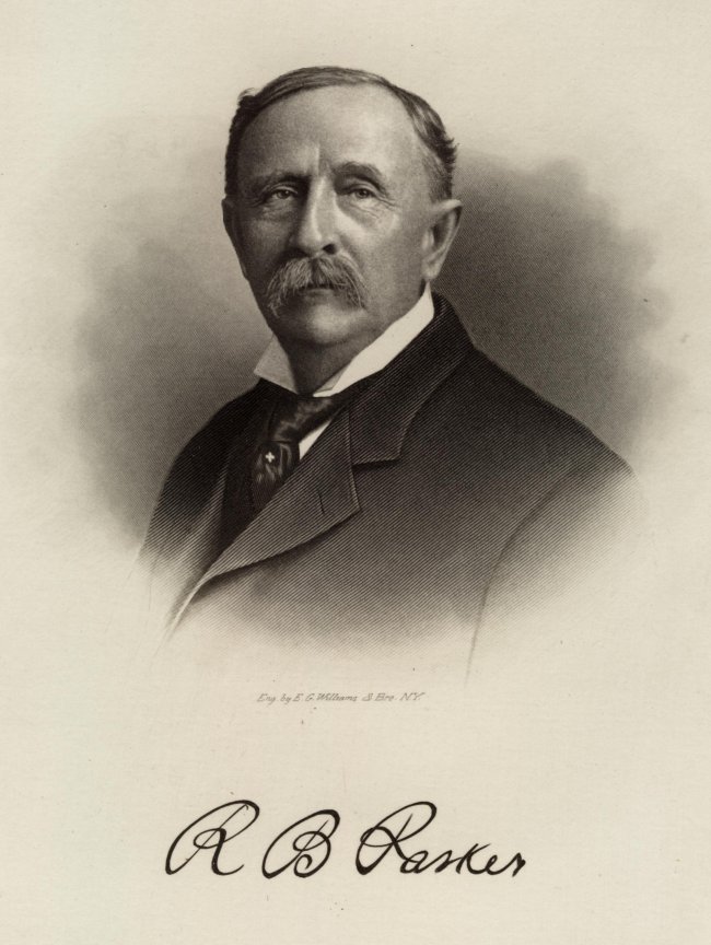 Also on March 27, 1866, The Centerville Company had sold the east mill to Rienzi B. Parker, who was the son-in-law of John Dobson, being married to Emma, his daughter. Rienzi Parker operated the mill on his own account until July 1, 1873. The mill had been badly damaged during a great flood on October 4, 1869, and had been rebuilt. On July 1, 1873, Mr. Parker sold the mill to the "Ravine Mills Company", a corporation formed on that date of which Rienzi B. Parker, his father Lucius Parker, and James Campbell became stockholders. Management of the company was solely in the hands of Rienzi Parker, whom owned one-half of the company stock. Rienzi Parker continued to operate that business until 1890.
Approximately 1909, the east mill was sold to Paul Ackerly, and he produced cheesecloth, twine and tobacco netting there. He often hosted community Christmas and children�s birthday parties in the mill. Mr. Ackerly moved his business to Georgia in the late 1920's. The mill fell into the hands of the Talcott Brothers and sat idle. It was torn down in the late 1930's.
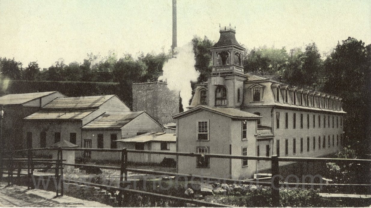
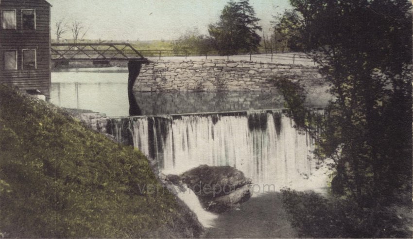
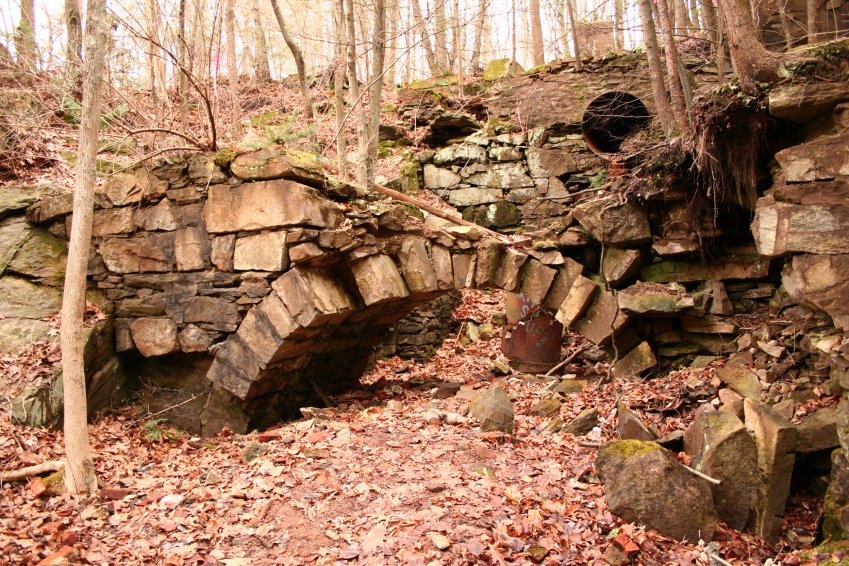
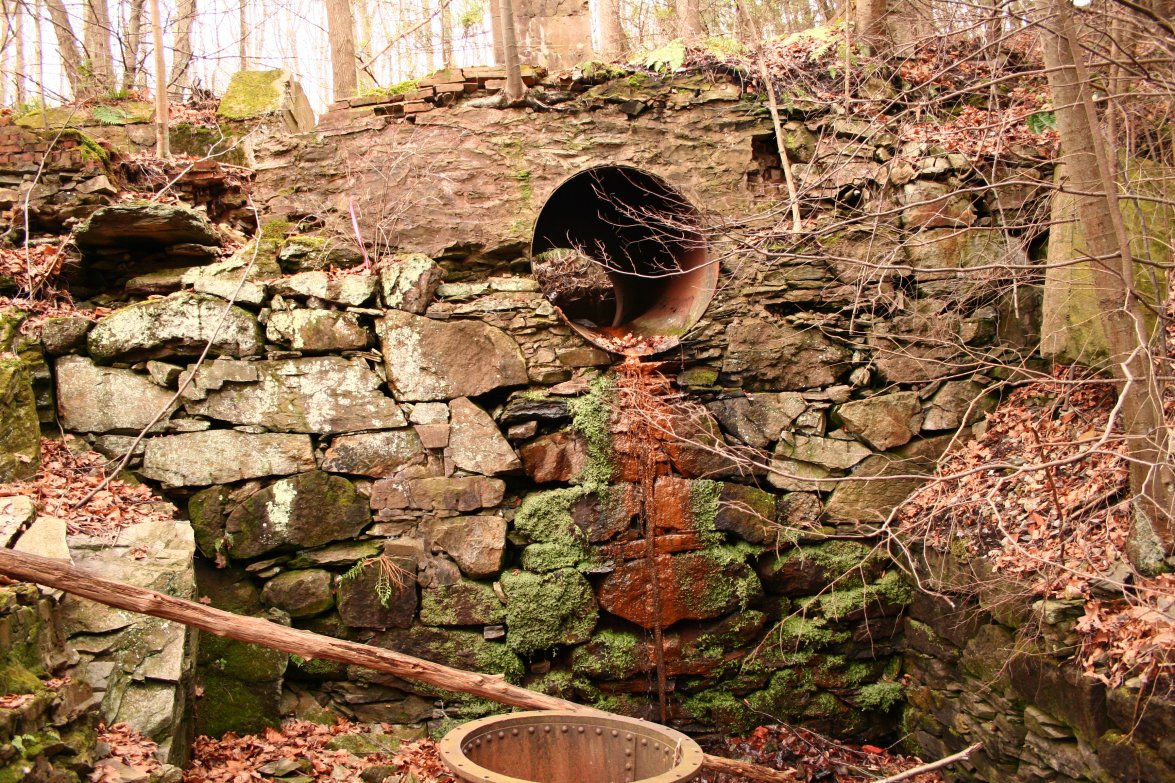
The above picture is of the east mill. There is no indication as to when this picture was taken, but I believe it was sometime after the mill had been rebuilt, as the previous structure was damaged during the 1869 flood. This image is from a postcard viewing the mill from the Dobson Road near or on the bridge looking west. The mill was located on the west side of Dobson Road on the south bank of the Tankerhoosen River. The north foundation wall, which runs along the bank of the river, had an stone arch opening for the tail-race of the water wheel. Ruins of that wall, stone arch, and wheel pit remain today.
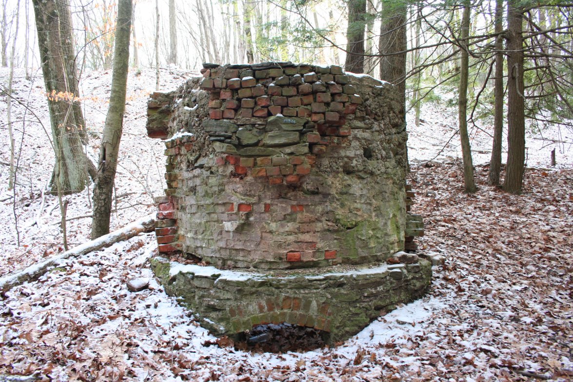
There is evidence that the original water wheel, most likely a breast shot wheel, had been replaced by a Francis turbine at some point. The mill had also been converted to steam power when this picture was taken. The tall brick structure to the rear was a boiler house. Adjacent to it on the right was a structure housing a steam engine, which replaced or supplemented power produced by water. The foundation for this power system is more recent than those of the oldest parts of the mill. The plume of steam in the picture would indicate the steam engine was running at the time. The mill's smokestack seen in the background was actually located up the hill near the railroad tracks.
The railroad grade is visible above the roofline of the mill. If you look closely at the shadows on the railroad grade,
you can make out the steam domes of a locomotive with the sun reflecting off of them. There is also what appears to be a plume of smoke and steam from its smokestack.
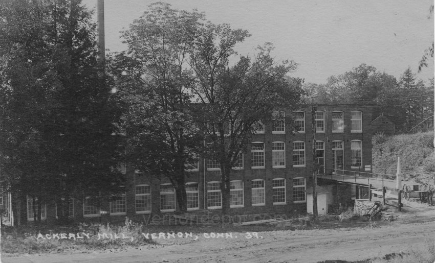
The Tankerhoosen River and the waterfall can't be seen here because of the line of site, but they are there to the right of the building. The embankment to the right is the north shore of the river. The building on that embankment was in the vicinity of the old well that is still there. There is a date monument in the corner of the mill, which, unfortunately, is partially obstructed by the railing on the loading dock. I have done high resolution scans in this portion of the picture and the date appears to be 1896 or 1898.
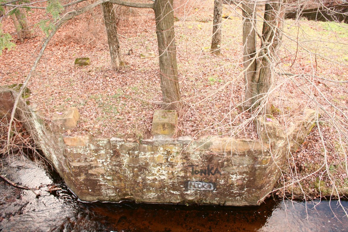
Peter Dobsons original east mill was rebuilt in 1852, to be rebuilt again after a flood in 1869 and I believe that is as it is appears in the first photograph. I believe in the 1890's, it was rebuilt or enlarged again, as it is shown in the above 1939 photograph. If you knew the area before the 1980's, you may remember seeing those posts sticking out of the ground that you can see here near the loading dock. Somehow, they managed to stay in place until they disappeared from the ruins when the new bridge was built on Dobson Road around 1986. Dobson Road was realigned as well, so much of area near the loading dock is now under the embankment of the road. The footings that supported the bridge between the loading dock and the building are still in place. Although mother nature has reclaimed the site, there are lots of remains of the mill at the surface.
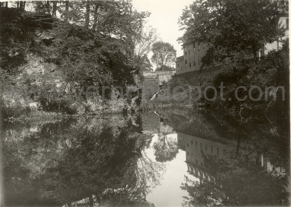
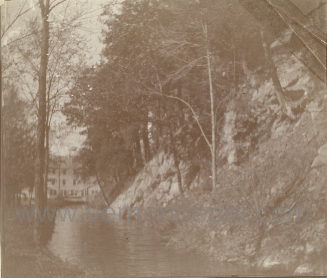
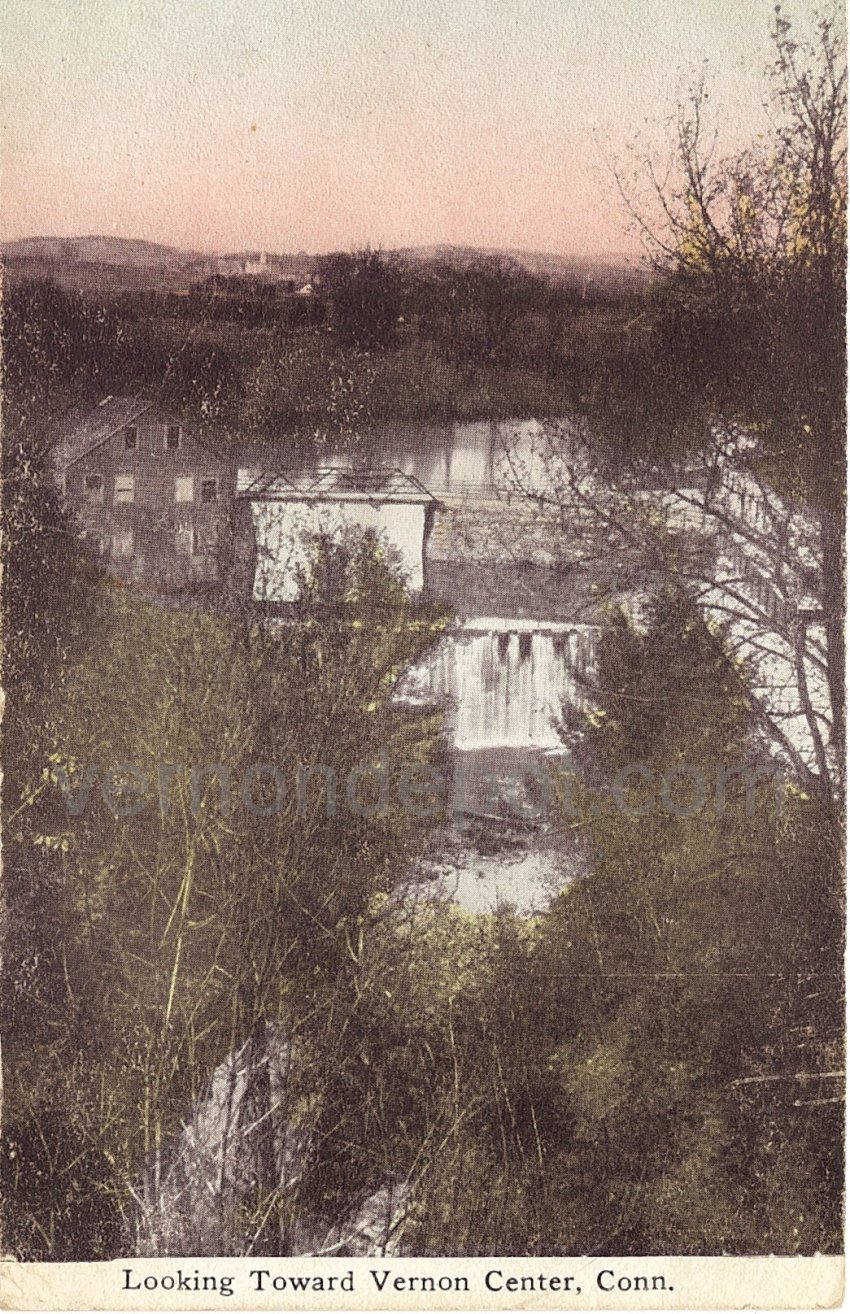
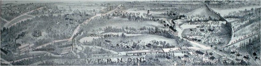
The mills built by Peter Dobson are at the lower left. Both east and west mills are shown. Two dams were built here on Tankerhoosen River, creating the Dobsonville Pond to supply water to power these mills. Some foundations of both mills remain today, and at the west mill site, dam remains and canal can be found in the woods on the north side of the Tankerhoosen River several hundred yards from of the east mill site.
The Phoenix Mill was upstream of the Dobson Mills, north of Vernon Depot. Its ruins are located at the present day intersection of Phoenix Street and Maple Street on the west side of Phoenix Street. The dam that created the Tankerhoosen pond is on the east side of Phoenix Street.
Click here for another great dam and mill website by a friend of mine. Great pictures and interpretation of other New England mill sites and lots of informational links.
I am looking for more pictures and information pertaining to the mills along the Tankerhoosen in the southern part of Vernon. In particular, I'm interested in the Phoenix Mill and the Dobson Mills. I have yet to find a picture of the west Dobson Mill or the Phoenix Mill. If you have or know of any pictures of these mills, please email me at admin@vernondepot.com.