Vignettes of Dobsonville
Updated 4/28/2011.
 |
 |
Looking north, the Dobson Road spanned the river on an iron truss bridge bridge. The Dobsonville pond is to the right. The road off to the left just beyond the bridge lead to the west mill, one of the two built and originally operated by Peter Dobson. It was located downstream and on the opposite side of the east mill. The east mill is out of the frame to the left. The three story house on the left side of the road belongs to Alfred and Charlotte (Dobson) Goodrich. Charlotte was the daughter of Peter Dobson. Peter Dobson's house is the one behind it on the hill to the left. Today, the on-ramp to I-84 eastbound occupies this location.
Click here for a Then/Now photo comparison. |
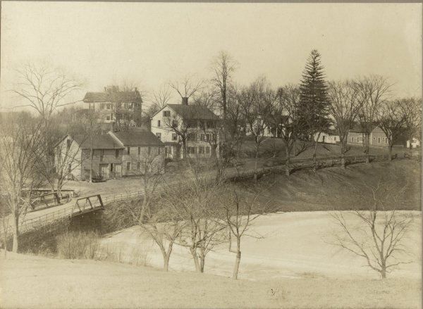
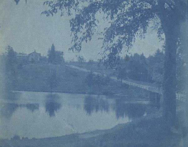
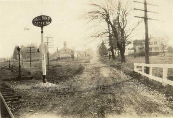
Looking south, the Dobson Road bridge spans the river on a wooden bridge at the time this photograph was taken. The Dobsonville pond is to the left. That road going off to the right just beyond the bridge is the access to the east mill, then known as Parkers Cotton Mill. The mill, out of the frame to the right, was built and previously owned by Peter Dobson. The man walking down the road is Rienzi B. Parker, and that is his home on the hill, He was the brother-inlaw of John S. Dobson, having married his daughter, Emma. Rienzi Parker owned the mill from the 1860's to the 1890's.
Telegraph poles can be seen further up the hill, where the railroad crosses the road.
Click here for a Then/Now photo comparison. |
 |
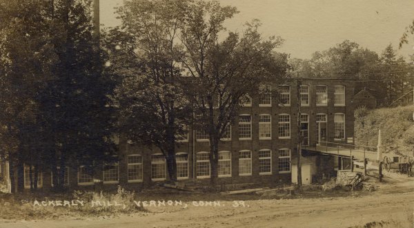 |
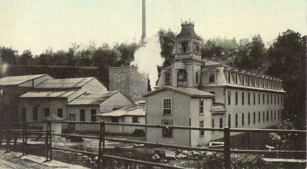
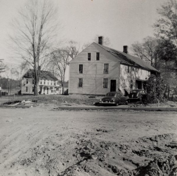
The east mill, the first of two built by Peter Dobson in the area. Viewed from Dobson Road, this mill was located on the south side of the river, with the dam and falls to the right of the building. The railroad bed can be seen up on the hill in the background. Read much more about the mills here. |
The same location as to the photograph on the left. This is what the east mill looked like more recent years. Paul Ackerly purchased the mill in 1909, made some renovations to it, and operated it as "Ackerly's Mill", making tobacco netting. The mill closed in the 1920's, and eventually demolished in the late 1930's |
 |
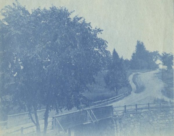 |
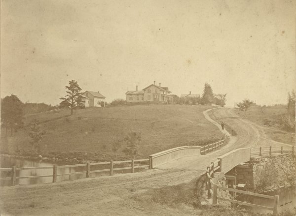
Looking south on Dobson Road from the north shore of the pond. The pond is in the foreground, with the bridge to the right. The Parker house is on the hill, and is one of only a few old houses that remain in the area today. |
Looking South on Dobson Road across the bridge from about the same perspective as the photograph about it. The bridge seems to have been replaced quite a few times, even in the early days, as it changes with the vintage of the photograph. |
 |
 |
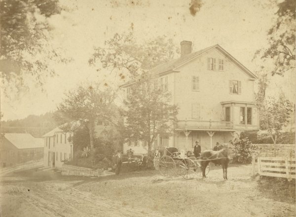
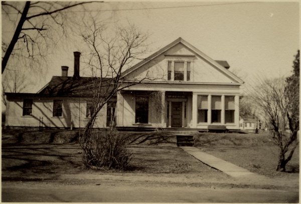
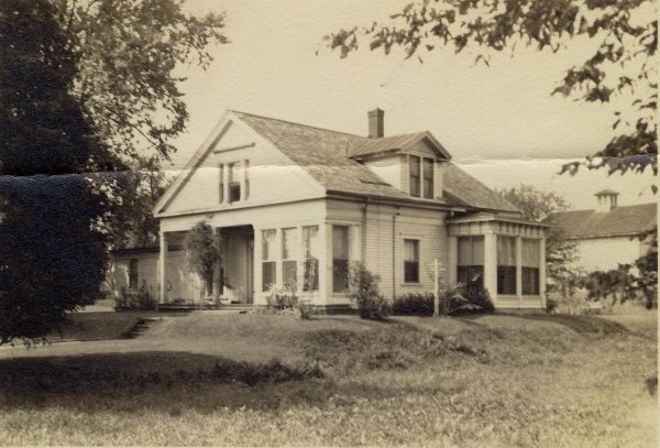
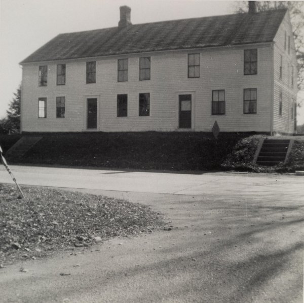
The Goodrich house, c1880, taken from Dobson Road looking south. From left: Doctor Alfred Goodrich, Charlotte (Dobson) Goodrich, Marie Antoinette (Talcott) Goodrich, Charlotte Goodrich (the child in the wagon), Rienzi B. Parker, and John S. Dobson. |
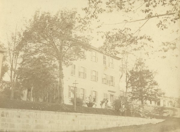
The Goodrich house. From left: Marie Antoinette (Talcott) Goodrich, holding Charlotte Goodrich, Charlotte (Dobson) Goodrich, standing behind Dr. Alfred Goodrich, whom is seated |
 |
 |
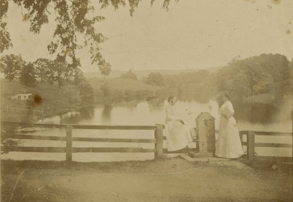
Looking east from Dobson Road. Opposite the Goodrich house was a pump for drawing water. The two ladies are Marie Antoinette Goodrich and Charlotte Goodrich |
The pond and pump, viewed from Dobson Road. |
 |
 |
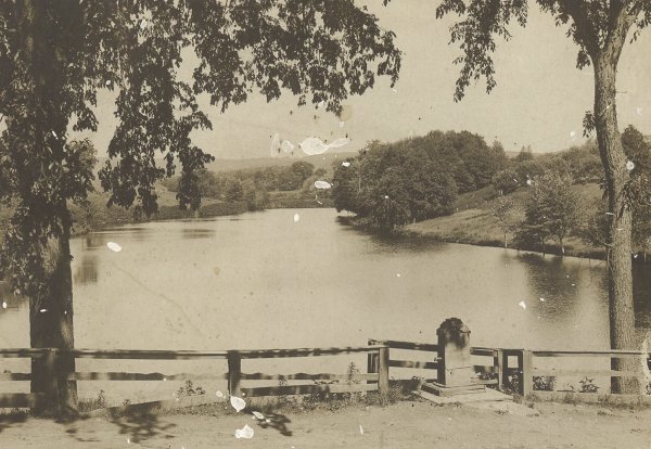
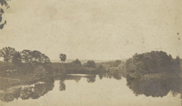
The pond, viewed from Dobson Road. |
The pond and pump, looking across Dobson Road, from a perspective on the access road to the west mill. The Goodrich house is out of the frame to the left, as is the bridge to the right. |
 |
 |
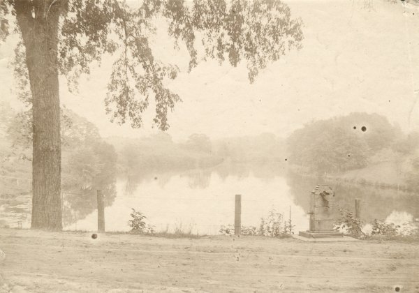
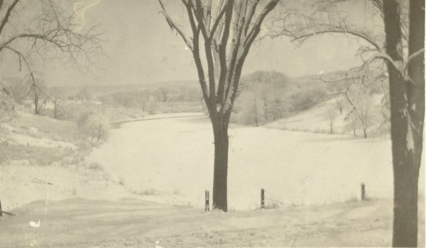
The pond, frozen over with a dusting of snow on the ground. |
The pond, viewed from Dobson Road. |
 |
 |
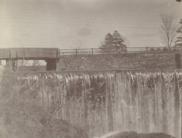
The falls and the dam, looking east, look more or less as they do today. Dobson Road and the bridge are in the background. |
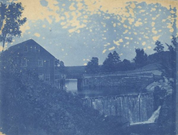
A wider perspective similar to the photograph on the left. The building on the left was built on columns set on the river embankment, of which remnants are still scattered about on the rivers edge. The east mill was to the right, and you can see a small bridge leading to it near the far right edge. |
 |
 |
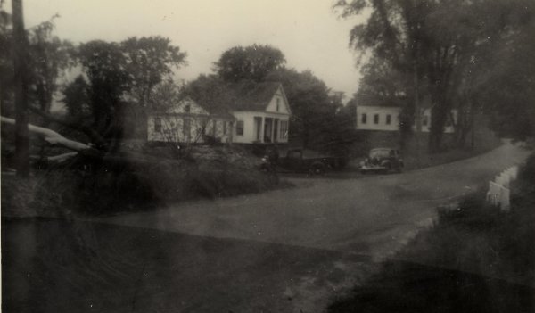
This is Dobson Road, looking north, its intersection with Hartford Turnpike in the distance. The house belongs to James Costello, his wife Jenny, and their daughter, Catherine. The house had been originally owned by John Dobson. James Costello was employed by the railroad as a signal tower operator. To read more about Mr. Costello and the railroad here. The building in the background to the right is the Dobsonville Schoolhouse, and was located at the intersection of Dobson Road and Hartford Turnpike. The Costello house was picked up and moved to Hartford Turnpike in the 1940's to make way for the new Wilbur Cross Parkway (known today as I-84). In the late 1970's / early 1980's, it was once again in the path of "progress", as the intersection of Dobson Road and Hartford Turnpike was relocated as part of the I-84 widening project. This time, the house was not spared, and it, along with the Schoolhouse, was torn down. |
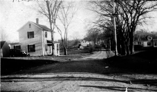
This is Dobson Road, this time looking south from its intersection with Hartford Turnpike. The house in the forground belonged to John Sullivan when this photograph was taken. John Sullivan was a blacksmith, and had a blacksmith shop nearby, just east of the present day Post Road Plaza. His daughter, Mabel, wrote a paper about growing up in Dobsonville, which can be viewed here. The house in the distance at the right edge of the photograph is the Costello house, which had previously belonged to John Dobson. Just out of the frame to the right is the Dobsonville Schoolhouse, and just to the left out of the frame is the former Dobsonville Tavern, which at the point in which this photograph was taken, had belong to Mabel Sullivan's Aunt Kate, who is mentioned in the story in the above link. The Sullivan house was moved to Campbell Avenue in the 1940's to make way for the Wilbur Cross Parkway, and it remains there today.
The present day intersection of Dobson Road and Hartford Turnpike is west of its original location. Today, the entrance to the New Alliance Bank and Post Road Plaza approximates the location in the photograph. |
 |
 |
The Costello House on Dobson Road. |
The Costello House on Dobson Road. |
 |
 |
The former Dobsonville Tavern at the intersection of Dobson Road and Hartford Turnpike. This old tavern dates back to the 1700's. It was converted to a private residence, and stood until the 1960's, when it was torn down to make way for the Post Road Plaza.
The intersection in the foreground is approximately the location on modern day Hartford Turnpike and Old Dobson Road. Dobson Road and Old Dobson were originally the same road, crossing Hartford Turnpike at a four-way intersection prior to the late 1970's / early 1980's. |
The former Dobsonville Tavern viewed from Dobson Road, looking east. The old Dobsonville Schoolhouse is to the left of the photographer. The house in the distance, to the left, is on Hartford Turnpike. The house gone now and a Professional Medical building occupies the location. Look between the house and the old Tavern, and you can see the "new" Vernon Elementary School. |
 |
 |
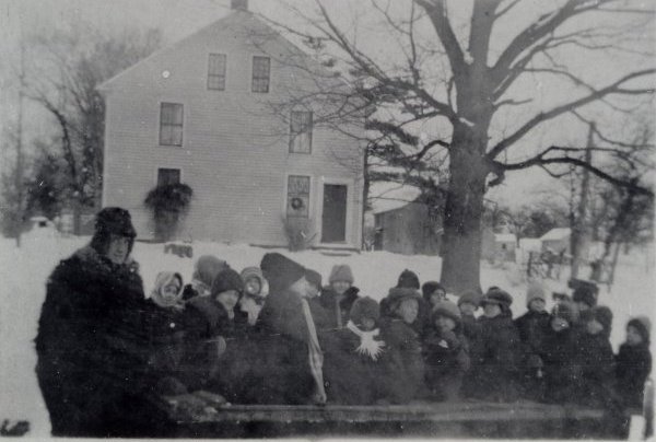
A group of children and a man, with the former Dobsonville Tavern in the background. The children appear to be on a sled or wagon. This photograph was among Catherine Costello's effects, whom was a dear friend of Mabel (Sullivan) Barton. The old Tavern had belonged to Mabel's Aunt Kate in this era. I would guess that Catherine and Mabel are among those in the photograph. |
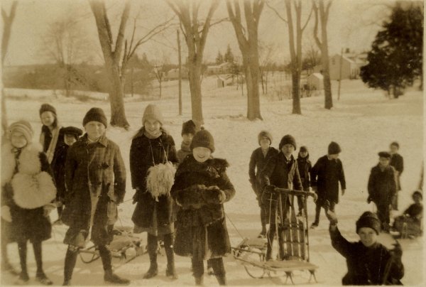
A group of children sledding in Dobsonville. I'm not positive of the exact location, but it appears that the Tankerhoosen River / Dobsonville Pond is frozen- over in the background, with the land sloping down to it from both sides. Catherine Costello is the girl front and center. |
 |
 |
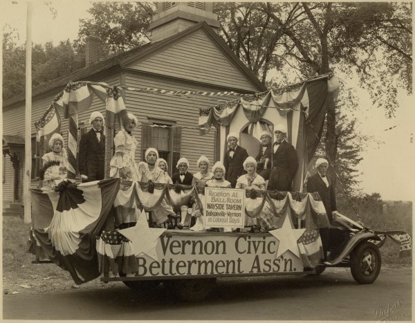
Parade float with the Dobsonville Schoolhouse in the background. The float is titled "Vernon Civic Betterment Ass'n" and the sign says "Reception at Ballroom, Wayside Tavern, Dobsonville-Vernon in Colonial Days". Catherine Costello the girl standing towards the rear of the float, to the right of the young gentleman. |
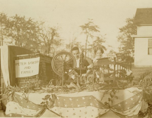
This photograph might be from the same event as the one to the left, possibly George Washington's 200th Birthday Celebration. This float depicts Peter Dobson and family. The girl in the photograph is Catherine Costello. |
 |
 |
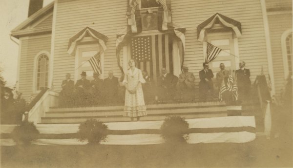
Celebrating George Washington's 200th birthday at the Sacred Heart Church in Dobsonville. A portrait of George Washington hangs above the door. Catherine Costello is front and center addressing the gathering. |
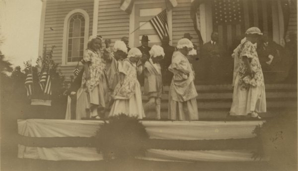
A group of children at the celebration of George Washington's 200th birthday. The church was located at the corner of Washington Street and Church Street. The church building still stands and was converted to a residence after the congregation moved to its current location on Hartford Turnpike in Vernon Center, in the late 1950's or early 1960's. |
 |
 |
Catherine Costello behind her home on Dobson Road. The Dobsonville Schoolhouse is in the background. |
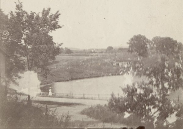
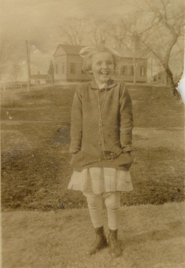
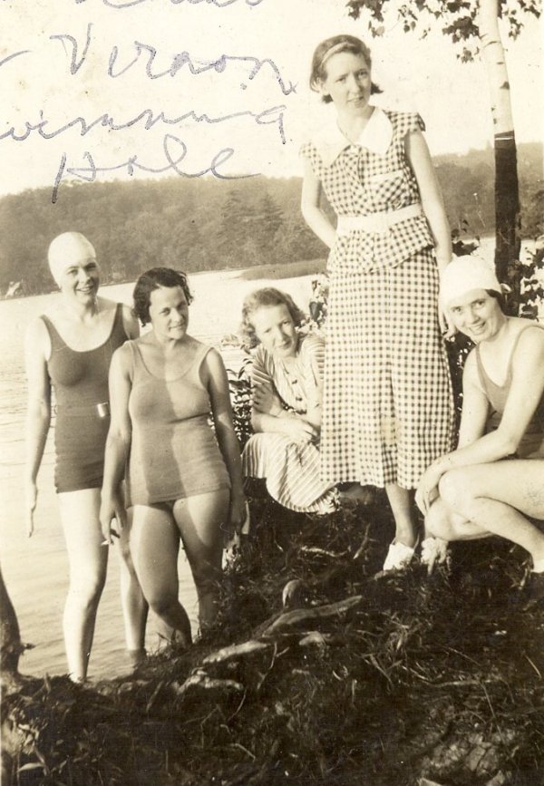
Evelyn Sullivan, second from left, with her friends at the Dobsonville Pond |
 |
 |
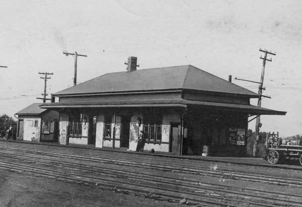
Dobsonville residents had easy access to transportation and freight services. This is the train station on Church Street. To read more about the railroad throughout vernon here. |
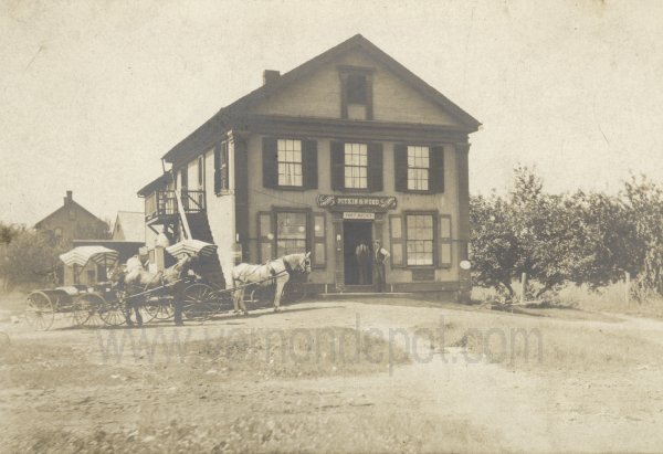
Directly across Church Street from the train station was the General Store and Post office. The building remains today as a residence. |
 |
 |
This is Washington Street, looking south from the railroad crossing. The Sacred Heart Church, which currently a residence, is on the left side of the road. The house on the right exists today as well. Church Street turns off to the left. |
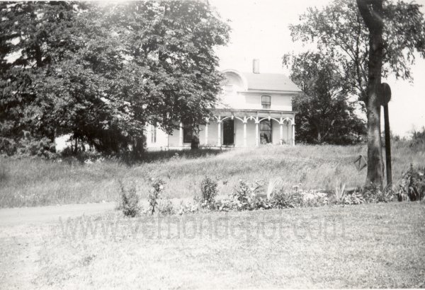
This is the house on Dobson Road that had previously belonged to mill owner, Rienzi Parker. It is owned by the Andrews family when this photograph was taken, and the house remains there today. |
 |
 |
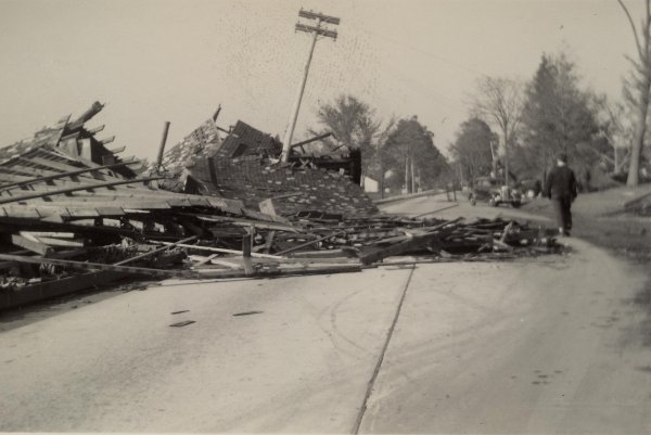
Storm damage from the 1938 Hurricane. This location is in front of the Vernon Methodist Church on Hartford Turnpike. There were barns across the street from the church, and one of them is scattered onto the road. The view is looking to the west, with the church out of the frame to the right. |
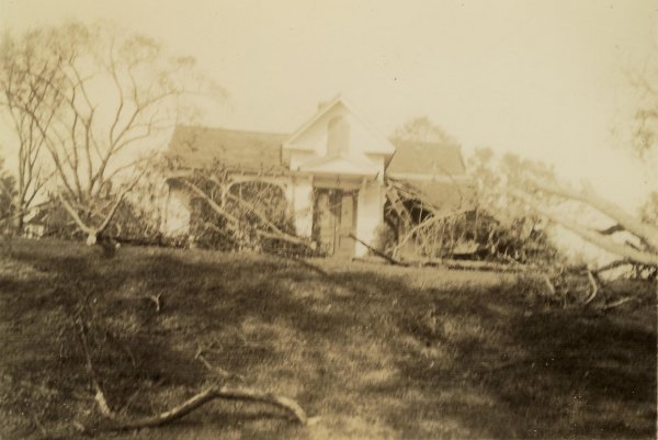
More storm damage from the Hurricane of 1938. |
That's all there is for now... Check back for updates as images become available.
If you have any vintage photographs of the Dobsonville area, in which you'd be so gracious as to contribute, or allow me to scan, please contact me.
I am also looking for photographs of the Dobsonville, Company 2 firehouse, which was located at the corner of Dobson Road and Hartford Turnpike. The little 3-bay firehouse, along with the Dobsonville Schoolhouse next door, was torn down in 1982 as part of the I-84 widening and Route 30 reconfiguring project. I'm almost ashamed to say that I don't have a picture of that Company 2 firehouse, since I was a member of that company from 1980 to 2005. We'd moved to the new firehouse on Birch Road in 1981.
Vernon's Railroad History
Mills on the Tankerhoosen River